

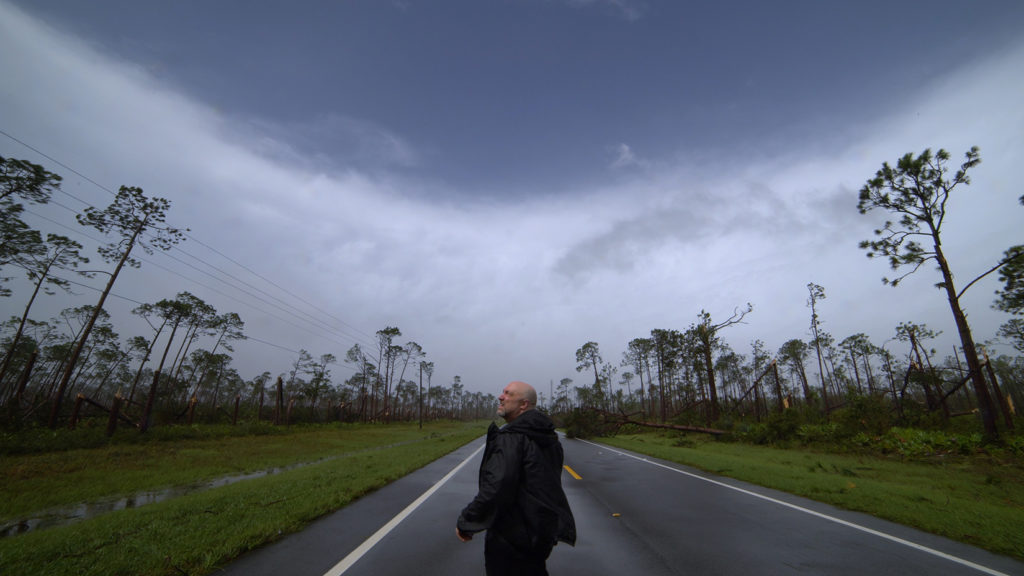
Doug Kiesling in the eye of Hurricane Michael
My name is Doug Kiesling, I have been a freelance extreme weather videographer and photojournalist for over twenty years. My work has been used throughout the media around the world and I am the owner and founder of a company called StormChasingVideo.com LLC (SCV).
While I have a personal blog page, which I almost never use anymore due to social media, and the company page for SCV, I created this page to be solely dedicated to the Hurricane Michael intercept in Bay County, Florida and focused on Mexico Beach.
Now I cannot properly talk about Hurricane Michael without giving you a little back story to the chase that took place over four months prior to the storm making landfall. On top of running a news video and archive footage company, I also do volunteer work with our church in Sartell, MN. Don’t worry, this is not a prophecy or end of times message.
What I’m referring to is a joke I made, well actually two jokes I made back on May 5th, 2018 and again on June 4th, 2018. Our music pastor and friends, Michael and Jaime Janetis www.michaeljanetis.com decided to follow their hearts and move closer to family in Florida to launch a new church, https://www.oceanschurch.org in Destin, FL. I’ll be honest, they hated the cold Minnesota weather and who can blame them? Unless you love winter, Minnesota is not the place for you.
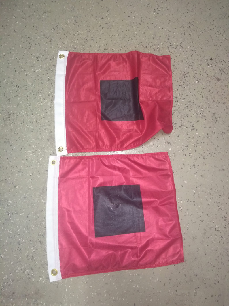
So to get back on point with the blog and the back story, when it was officially announced back in May on the weekend of the 5th, I joked with Michael about how he might be leaving Minnesota but I have a feeling the bad weather might not be done with him yet as there was a hurricane named Michael on the list this year from the National Hurricane Center.
I joked that here was their new state flag. It was a pair of Hurricane Flags I had hanging up in the garage at the office. Remember this was on May 5th, 2018, a full five month’s before Hurricane Michael hit the Florida Upper Gulf Coast.
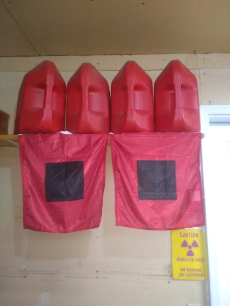
Then fast forward to a month later, jokingly I told Michael that I would see him again in a few months to bring him his going away / housewarming present, fuel cans and some Hurricane Flags for Hurricane Michael.
One more thing to also mention is that for the past few years, I have only had the opportunity to chase a handful of tropical storm systems. The last one prior to Hurricane Michael was Hurricane Matthew that hit Florida and the east coast back in October of 2016.
Now being a new dad with mom and seven-month-old baby girl at home, I was torn between wanting to chase and being a parent since I did have a crew of freelancers or “Stringers” that work with SCV that were covering the storm but I needed to get back in the field. As Matthew gave a glancing blow to the east coast of Florida in the early morning hours and then rapidly moved north, up the east coast, I will be honest, I had fun intercepting Matthew and seeing its power as it got closer to the coast of Florida. I also wanted to get home ASAP and I knew I had others to cover the storm for me. So I was able to find a flight home out of Fort Myers, FL that same afternoon as Matthew was racing up the east coast and less then twenty four hours later, I was at home in Minnesota with my family.
In 2017 I missed out on chasing the entire hurricane season as I agreed to do a bunch of volunteer work with church for their ten year anniversary that just so happened to be on the same dates as Hurricane Irma and I was booked for shooting video when Hurricane Maria hit.
For Hurricane Harvey, I’ll be honest, I did not like that storm’s setup and timing. Harvey was forecast to come in during the middle of the night and you can’t see anything in the dark when the power is knocked out. Also, there was a chance that it could move further west and come into the South Texas Gulf Coast area known as the King Ranch. The King Ranch is located between Corpus Christi and Brownsville, Texas. It is an area that is so huge that is just under 1,300 square miles. Yes, One Thousand, Three Hundred square miles or just under half the size of the state of Connecticut or almost twice the size of the state of Rhode Island, and that is just a ranch where virtually nobody lives and no roads to chase.
With the 2017 hurricane season in the books, as a chaser and lifelong weather nerd, it stung a little to see friends intercepting the storms while I was at home. Granted I helped work their video for SCV but still it was taking the chaser out of the chase.
We are now into the 2018 Hurricane Season and I have already made some jokes about seeing my friend Michael for Hurricane Michael back in May and June. Now September comes around and I did make a prior commitment for the week that Hurricane Florence hit so I was not able chase once again and once again left feeling like a pro athlete being benched.
It was the first week of October 2018 and something was telling me, just wait… I was watching the long term forecasts that I use from www.F5WX.com and something was brewing off the coast of Belize but it was still several days away from anything actually forming.
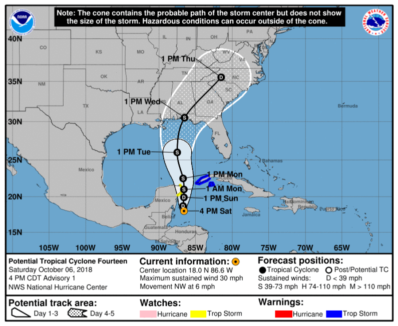
On Saturday October 6th, The National Hurricane Center (NHC) issued an advisory for “Potential” Tropical Cyclone Fourteen as of their 4:00PM CDT update.
I was thinking, could this be the storm that I finally get back out in the field to chase? I had zero commitments scheduled other then bringing our daughter in to day care in the morning and Neva (my better half) could change her work schedule a little to cover bringing her in to preschool daycare in the morning for the following week if the chase was on. Or would this be another false alarm?
Looking at the forecast graphic, I thought to myself, wait, it shows a 1PM Wednesday land fall and pretty much right over the area where Michael moved his family to, in Destin, FL. I thought to myself, naaaaa, coincidence…
I went to bed late that night, or you could say early on October 7th after the 1:00 AM the Advisory 2A forecast came out from NHC that still said it was still a “Potential” Tropical Cyclone Fourteen.
I did check the satellite images and there was something brewing over the open waters, just nothing to get totally excited over yet. 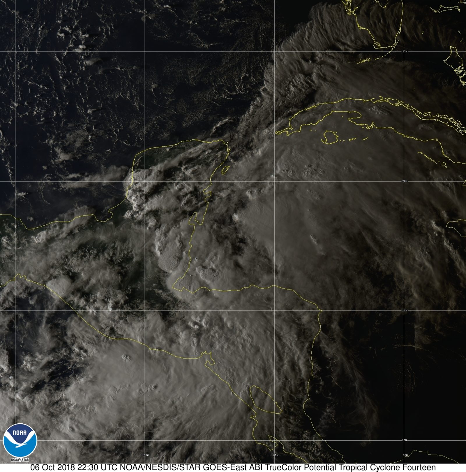
That morning I woke up to check data before church and saw that the storm was now Tropical Depression Fourteen with a possible daytime landfall in the works as of the 10:00 AM Advisory Number Four.
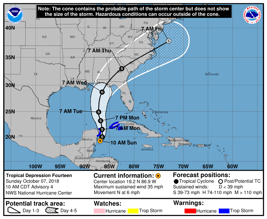
The track was a little concerning as it could go left of center and hit a highly populated area with the right front quadrant of the storm this is the most powerful part of the hurricanes wind and storm surge, or it could go right of the track and into the armpit of Florida where the population is a lot less with very few towns along the coast from Tallahassee to just north of the Tampa Metro area.
Later that Sunday, by the time we got home from Church and we were getting ready to have Lunch, I checked the 1:00 PM forecast and satellite images and wow, it was now Tropical Storm Michael with a Wednesday morning daytime landfall.
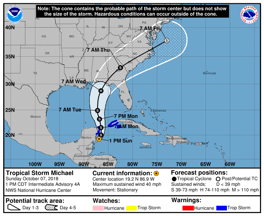
At this point, I was thinking, ok, how do I get down to Florida fast. It would take me 24 hours to drive straight down to Florida from our home in Minnesota. I would have to leave that afternoon if I was going to be able to make it into position in time for the storm and scout out locations and not sleep for days and be a wreck with no sleep. The other option was to find a flight but that would take some time to research a flight and backup flights in case the flights get canceled.
For the rest of the day I pretty much was pouring over all the forecast models, NHC forecasts, Satellite data and making my own deductions of what was this thing going to do. Once again it was another late night so by 1 AM CDT on Monday October 8th, I was a mental wreck and now there was a hint that the forecast track could slow down and head for the arm pit of Florida.
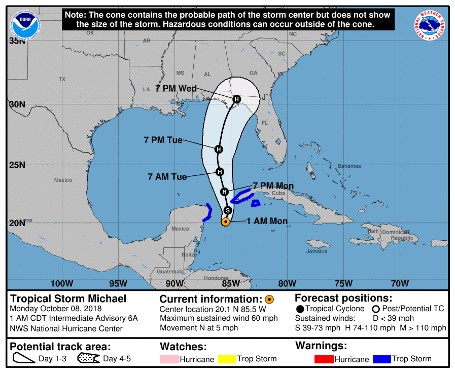
After a few hours of sleep, I got up and take Laura to preschool / day care at 7:00 AM in the morning, it was back to forecasting and researching flights options, if any, since the airlines were starting to cancel flights for a possible tropical storm or maybe a category one hurricane hitting in a couple days. I watched the forecast data that morning when it was upgraded to a hurricane with a Major Hurricane status coming in Wednesday but with a chance it could come in at sunset.
Monday afternoon I ran probably a hundred different scenarios about how I could get to the target area, get supplies, would it come in just before sunset or daytime landfall, would it be a Cat 3 or maybe a Cat 4 and would I have anyone with me as a chase partner or would I be solo?
I was at the point of thinking maybe it was just not in the cards as the flights I was looking at were now canceled or others were now being increased to the point of was it worth it to pay over a grand one way just to chase? Neva picked up Laura from school and got home from work when I told her about the what if, maybe, flight issues, cost of the flights now skyrocketing to get into the area. She told me “if you don’t get out of here and go chase this one, I don’t want to be around you for the next month if you miss this storm!” That was it, that was her way of saying SHUT UP AND GO CHASE THE STORM!
While we were talking about all the what if’s and how to, the 4:00 PM CDT forecast came out. Major Hurricane, 1PM Wednesday, for the Panama City, FL region.
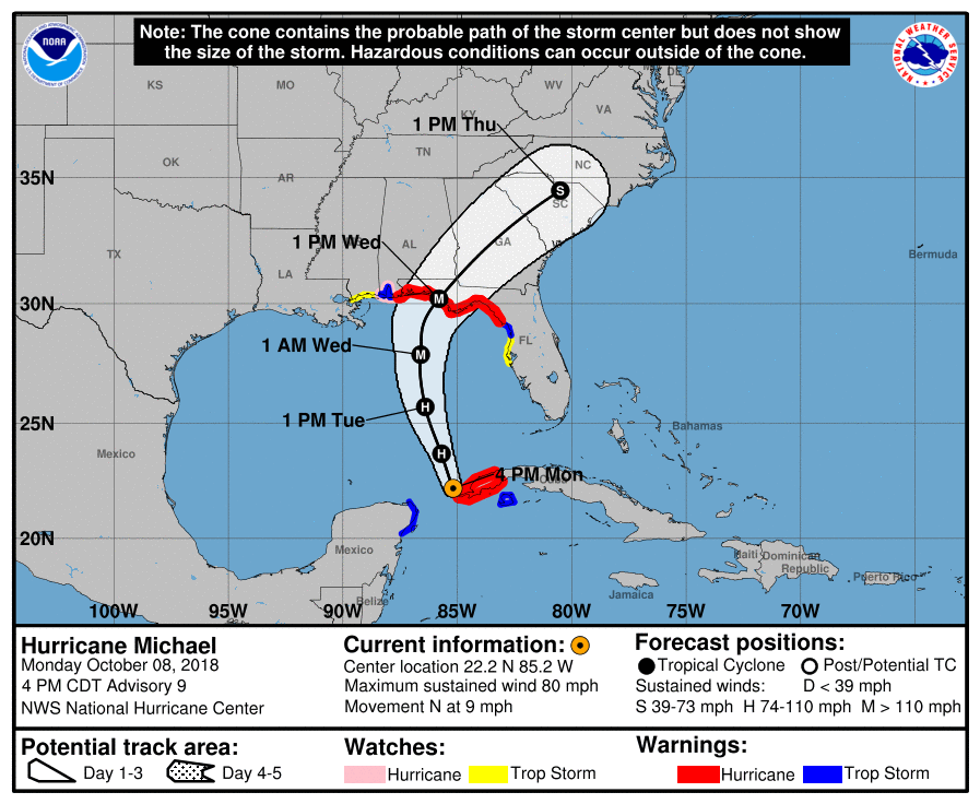
Looking at the latest forecast from NHC and knowing it was less than 48 hours until landfall and Neva told me to get out and chase, I had to come up with a plan from all of the scenarios I ran in my head of how to make this chase happen.
I stopped and took a deep breath and said a prayer that if you want me to make this trip, make it happen lord. I took one last look at flight options to fly into Atlanta and then of all places, Jacksonville, Florida which was now outside of the hurricane cone from NHC. What I found earlier was a $1,000.00 or more round trip flight even on Southwest, was now listed for just over $300.00, round trip. That was less than the coast of fuel to drive down there. I had the flight lined up but not booked as I would still need a vehicle and supplies that I can’t fly down with like fuel cans, bottled water and food. The next step was to find a rental SUV and hope to get a decent price with full insurance in case of worst-case scenario. I say worst-case because the SUV is pretty much your home, your lifeline, your escape in the hurricane. You don’t want anything to happen to it as it will be your only way out after the storm.
By some dumb luck, while looking for a rental car and trying to find my member number in my older emails, I got an email offer from my credit card company for discounted rental cars with a major rental car company. This now turned into a major discount because I found a rental for several days with full insurance for less than the price of the round-trip airline ticket. The stars were really starting to line up and it was becoming a little strange, almost too easy.
So now I had the flight website all filled out and ready to book with one click along with the SUV rental that was ready to be reserved. The final piece of the puzzle was supplies. After a quick search and phone call, I found a place right by the airport that had everything I needed and prepaid the supplies over the phone to pick up the following afternoon after I landed in Jacksonville.
Now that I had the survival supplies, I booked the last-minute rental and airline tickets all within minutes of finding the flight. This was way too easy, something had to be setup to fail and go wrong. With that being said, I had hours to get all my gear ready to fly out first thing in the morning. Finally, I did book a few hotels to base camp out of with backup plan hotels. In most cases, the hotels will still be open but only for staff, their family and the media. One thing I have learned going all the way back to 2005 hurricane season, the hotels are there to make money and if they are not damaged or destroyed, they want to be back up and running as fast as possible for the massive influx of government contractors and people needing someplace to stay after their homes were destroyed. They also want to take care of their staff in the event their homes are damaged or destroyed so they have a place to stay and work. What good is having a hotel that was not damaged with no staff?
After getting everything packed up and ready to go, I did not get much sleep that night, okay I did not sleep at all and slept on the flight from Minneapolis to Atlanta before praying all my gear made it to the connecting flight to Jacksonville, or I was pretty much out of luck.
After I landed in Jacksonville, I was in luck, all my bags made it just fine, the rental was waiting for me and within minutes of leaving the hotel, I had all my survival supplies including several new fuel cans. All that was needed was a quick stop to top off the fuel cans and to insure I have a tank of gas in reserve if needed and then it was a five-hour drive to Destin, FL.
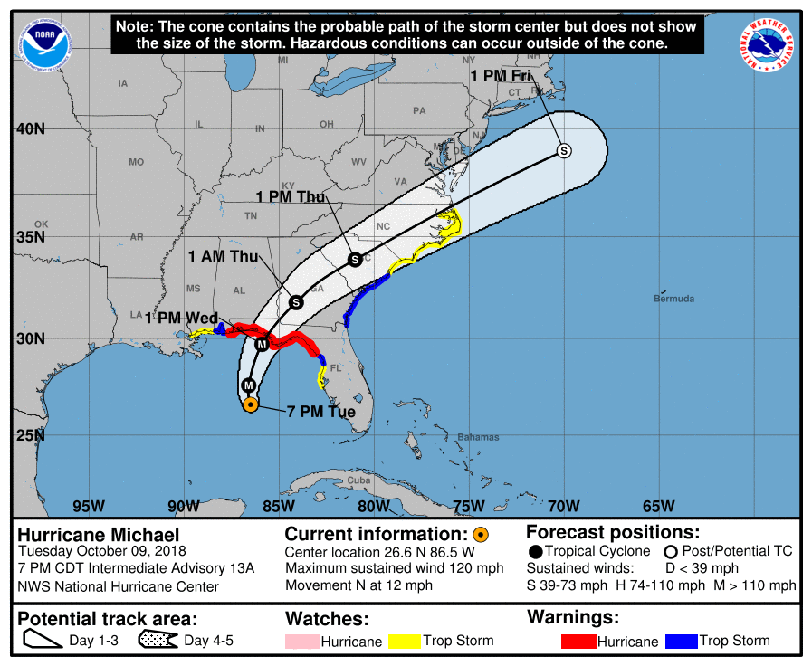
The time was just after 7PM on the evening of October 9th, I checked into the hotel in Destin, Florida with all signs that hurricane Michael’s eye will hit the area from Mexico Beach, FL to Panama City Beach, FL. Michael was category three on the Saffir-Simpson scale with sustained winds of 120 mph.
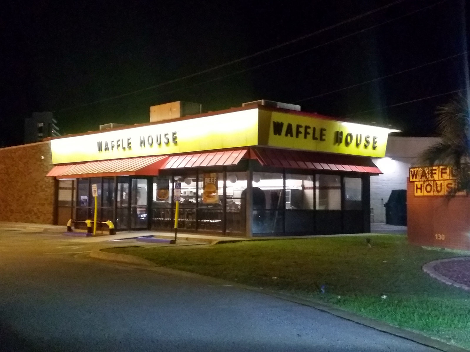
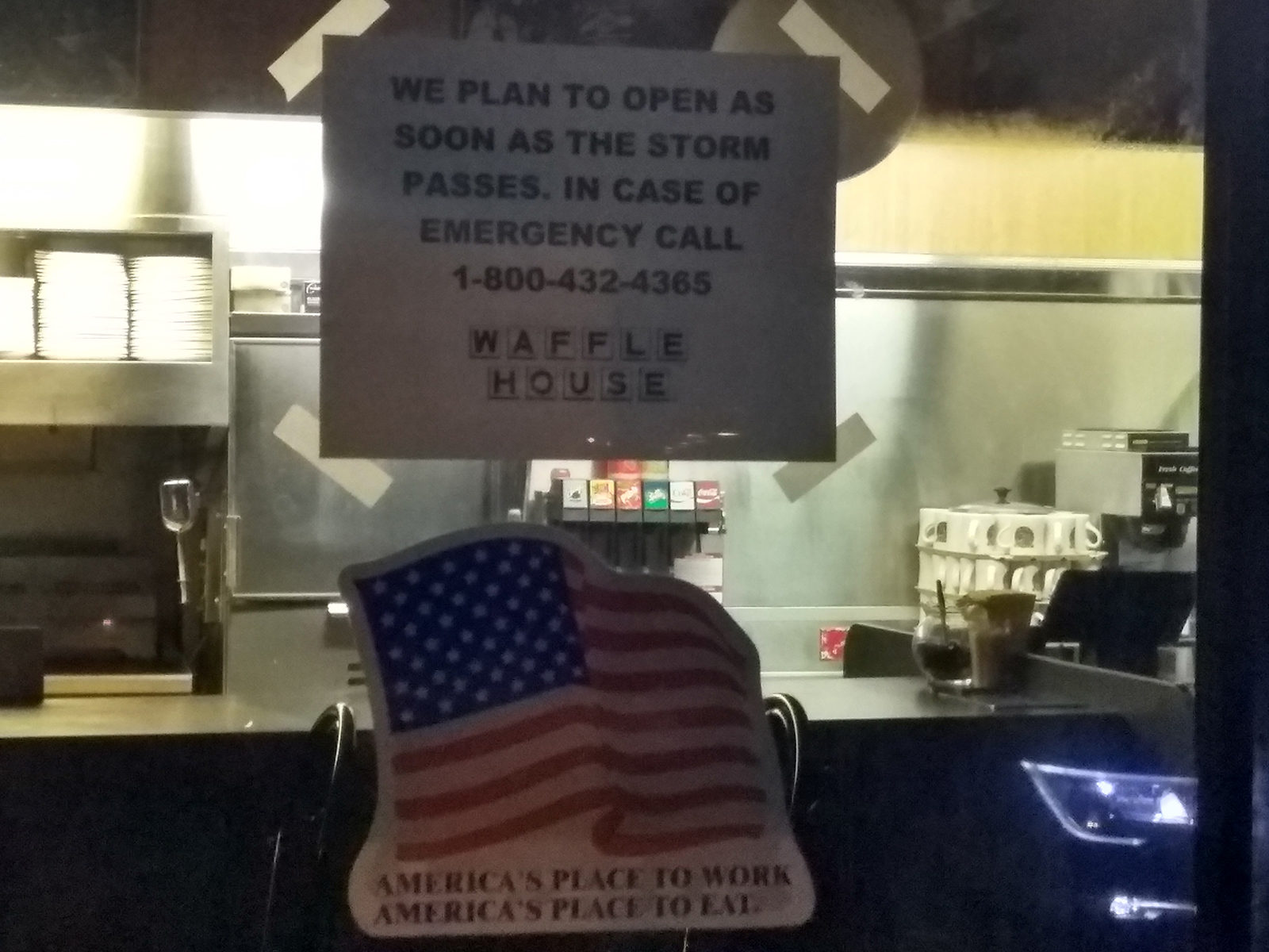 One sign that chasers use to determine how severe a storm is, it is kind of a joke but true, it is the measure of how many Waffle House locations are closed for the hurricane since those places almost never close. The weather in Destin was very calm but there was this overwhelming feeling of dread in the air. The storms impact was less then 12 hours from hitting the coast and its final point of worst impact was still anyone’s guess.
I did keep my friend Michael and his family informed that this storm could still hit Destin the next morning with more than just a glancing blow. They might want to bug out of the area and spend the night someplace west of Destin, like in Mobile, Alabama. The storm was picking up strength and by 10:00 PM it was already up increased to a 125 mph sustained winds.
A little after 1:00 AM on October 10th, I got a message from my friend Michael, he said they were leaving Destin and heading west as it was upgraded to a Cat 4 with winds of 130 miles per hour.
I told him that was probably the best idea as the storm track was still uncertain and Destin was in the cone for possible impacts.
To see all of the NHC forecast graphics, check out this link. https://www.nhc.noaa.gov/archive/2018/MICHAEL_graphics.php?product=3day_cone_with_line
After about five hours of sleep, I woke up and got ready and was out the door by 7:00 AM I was asked by a couple of local media outlets that were covering the storm in Destin what I thought about the storm and if I had any last minute advice for people that stayed behind to ride out the storm. The simple answer was that I came here from the other side of the country to see this storm and have been in a dozen or so other tropical systems, including Hurricane Charley and Hurricane Katrina and this one scares me more then the others as it keeps growing. When I went to sleep, it was only 130 mph and now it is 145 mph and it is still gaining strength. This could reach Category Five by landfall at the rate it is going.
After wrapping up shooting some footage of the big waves in Destin and doing the last local news interview. I started working my wait towards Panama City, FL and refining my target. I did live stream this chase and to safe you the viewer the agony of watching the boring drive from Destin to Panama City, Florida, and for our subscribers on Youtube, I posted a replay video of the chase that you can watch here. It starts out before I reach Mexico Beach and continues through the point of the eye where I lost virtually all cell phone communications except for text messages.
From this point forward in the blog, I will be going over what happened and referring back to the live stream replay video.
Remember I am still alone at this point, chasing a very strong Category 4 hurricane with winds of 145 miles per hour as of the 10:00 AM CDT update.
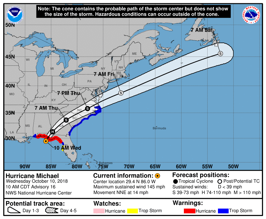
About this time, making my final forecast and assessing the situation of the storm, the topography of the landscape, the forecasted storm surge, even the wind field of the storm as it lined up with the roadway where the point of greatest impact would occur.
I was driving through Panama City, FL and heading I am entering Mexico Beach, FL and even though I was chasing one of the most powerful storms to hit the United States in the last one hundred years, I was not alone as I knew I had some friends nearby along with now casting help.
I talked with my friends Juston Drake and Simon Brewer who were in the area chasing Michael and were also considering a run to Mexico Beach. I talked to my friend Chris Collura who was still picking the final target to intercept. I let them know where I was and what my plan was.
Along with the friends nearby, I was also getting now casting (real time forecasting) help from a couple of friends, Brian Dombrowski, Scott McPartland and Blake Michaleski who where calling and texting me and keeping me updated on the surge heights and increase of winds being reported by the Airforce Hurricane Hunters.
One of the most nerve-racking drives of my life that compares to driving out of New Orleans, LA as the levees were failing after Hurricane Katrina came ashore or the massive South Dakota Blizzard of October 2013, was the drive on highway 98, going to the southeast through Tyndall Airforce Base. The tall pine trees that lined Highway 98 from Panama City to Mexico Beach were extremely dangerous as they were starting to break apart.
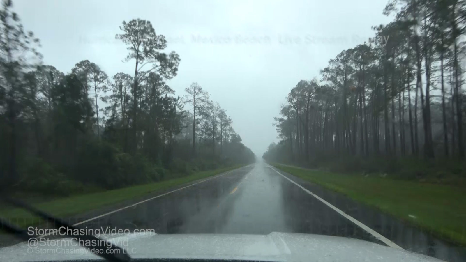
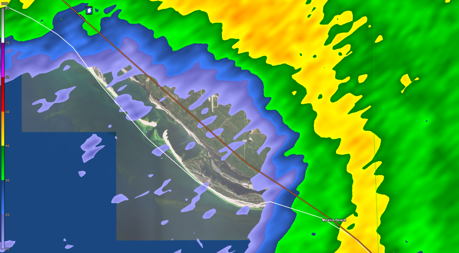
The calculated risk that I made for driving over from Panama City to Mexico Beach was that the surface winds were not that strong, it was barely tropical storm force at this time. Also, a major factor was that the winds were almost parallel to Highway 98. So while there would be tree limbs and parts of tree’s being broken off, the odd’s were in the favor of them not blocking the roads at this time. The worst of the destruction of the tree’s would be as the eye wall neared the coast and mowed down the tree’s in the 100+ mile per hour winds. Below is a radar loop I made to show what I am talking about as the winds would blow most of the tree’s and debris down with the roadway.
As I drove into Mexico Beach, I did not encounter any traffic except near the entrance of Tyndall Airforce Base. After passing the entrance to the base, there was no traffic leaving the area and nobody else coming in behind me.
The only other people I saw in Mexico Beach until the storm was over was a few people that were in the El Governor Motel and were leaving. Beyond that, it was a ghost town, there was nobody else on the Streets and no sign of life except for me.
I began to shoot footage of the waves and the debris starting to fly around near the El Governor for about a half an hour along with live streaming what I was seeing. A few minutes into documenting the storm at the hotel, something was telling me to MOVE THE SUV, PARK IT OVER THERE, NOT HERE. I did so and not knowing why I needed to, I thought it was my sub conscious telling me to move it next to an outbuilding in front of the motel to use as a wind block and be next to the vehicle if I needed anything.
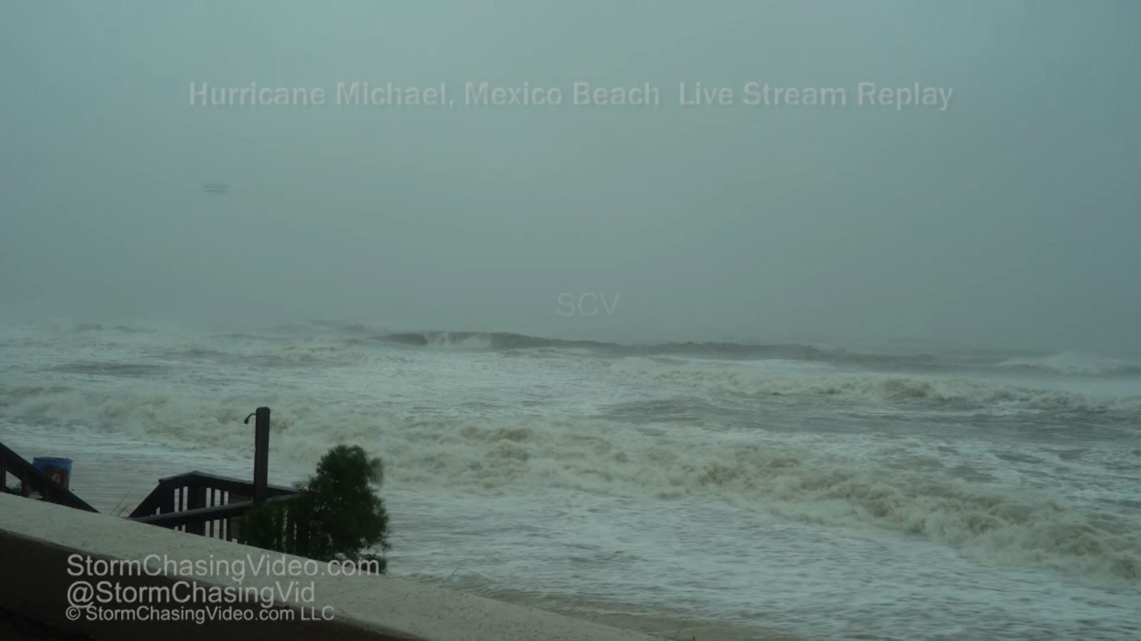
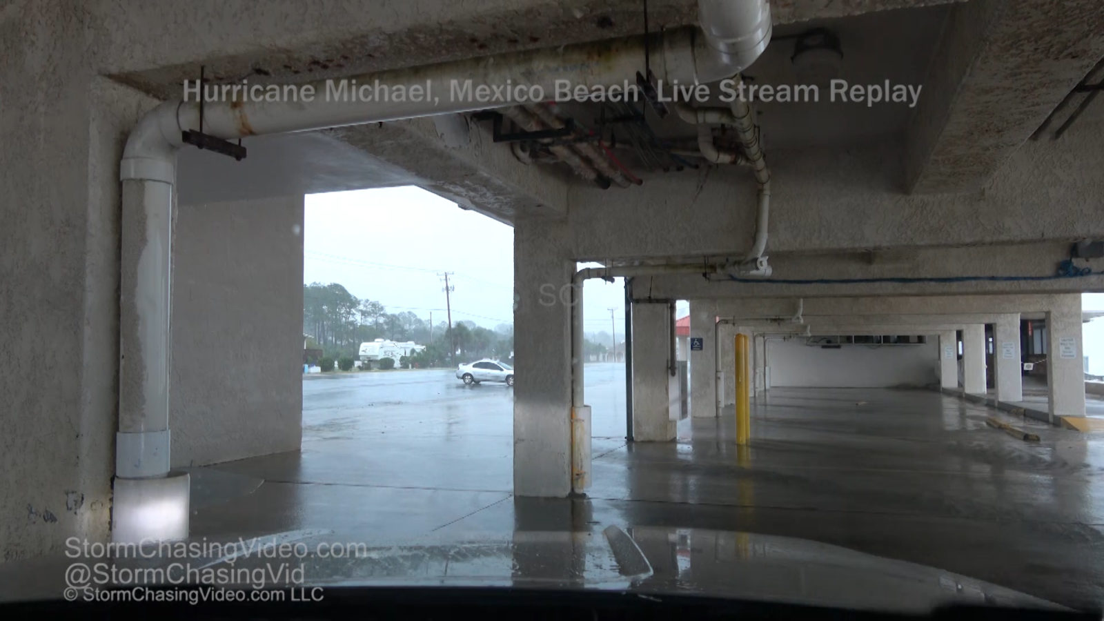
A few minutes later, I heard a loud crash!!!! It turns out near where I was parked under the building, um yeah, the building was starting to come apart as the upper parts of the stairwell walls started being blown out by the wind as there was openings along the stairwell for the wind to blow into it in the upper floors. With large debris falling from the upper floors of the motel, this was not going to be a safe place to stay much longer and I knew I needed to get moving. I did move the SUV one more time to document the wall of the stairwell that was missing and large debris falling out from the upper floors.
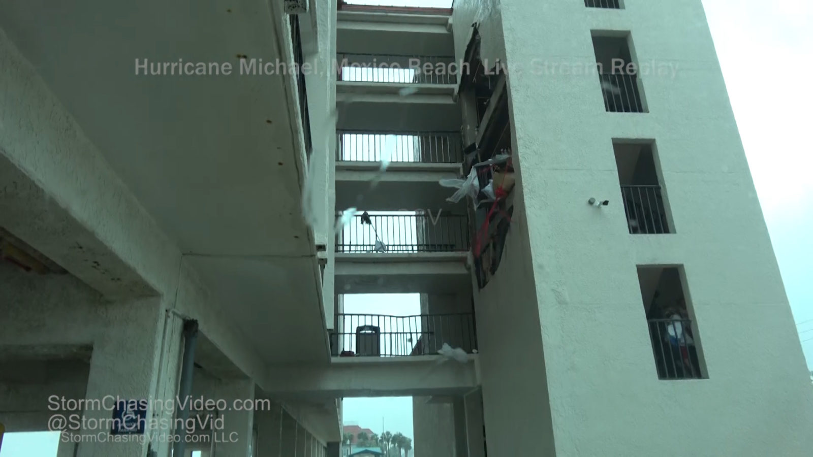
I mentioned earlier about seeing others in Mexico Beach that I saw a group of people leaving the motel from the upper floors and get into a vehicle and drive off. This was when I saw them as the hotel was starting to get blown apart. The did get into a vehicle and drive off and what happened to them, I have no idea, but I hope they got to higher ground.
From here it was just before 11:00 AM and I wanted to get a quick look around the town before the worst of the winds and storm surge came on shore. I drove over to 15th Street and Highway 98 before stopping to look at data and reassess any last-minute changes or evacuate out of the area.
I did not want to venture any further to the southeast from this point as I knew the surge would come in and I needed to make sure I had a clear path out of town to the northwest on Highway 98. You can see on the map, just to the northwest of Mexico Beach, there is about a mile distance from the shoreline with the Saint Andrew Sound.
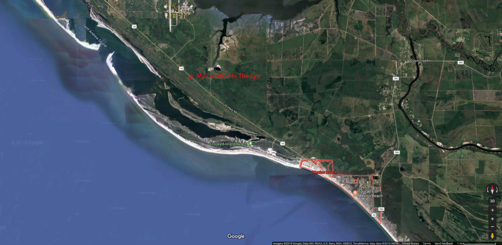
While Mexico Beach is right on the coast and the western edge of the town was pretty much doomed with the storm surge approaching, three miles to the northwest I could make it over a mile inland from the barrier of the shore line and a half mile away from the secondary shore line in the Saint Andrews Sound and into the meridian of where the heart of the eye of what was now a near Cat 5 at 155mph winds was going to come on shore.
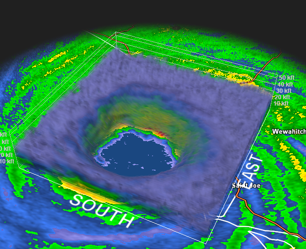
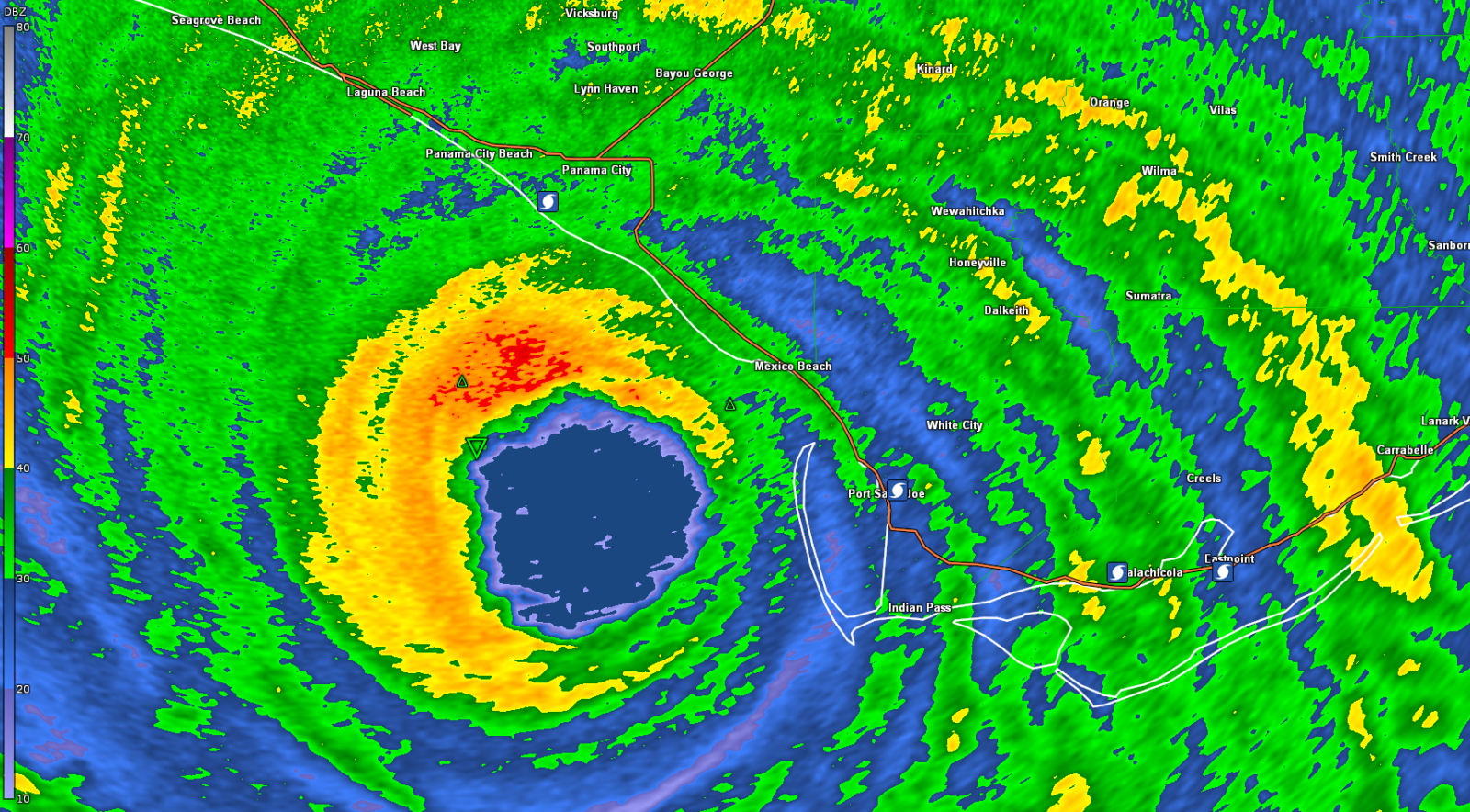
I started to make my way back to the northwest as the eye was approaching within the hour when the winds were starting to really pick up and get violent. I saw a stop sign pretty much having a high wind convulsion and flopping around from a parking lot or driveway near 23rd Street and Highway 98. I found out later on the GoPro camera I had mounted on the roof, there was large roofing sheet metal debris flying at me that was out of my personal line of site but for some reason, it got caught up in the power lines right above me and I was untouched by the debris.
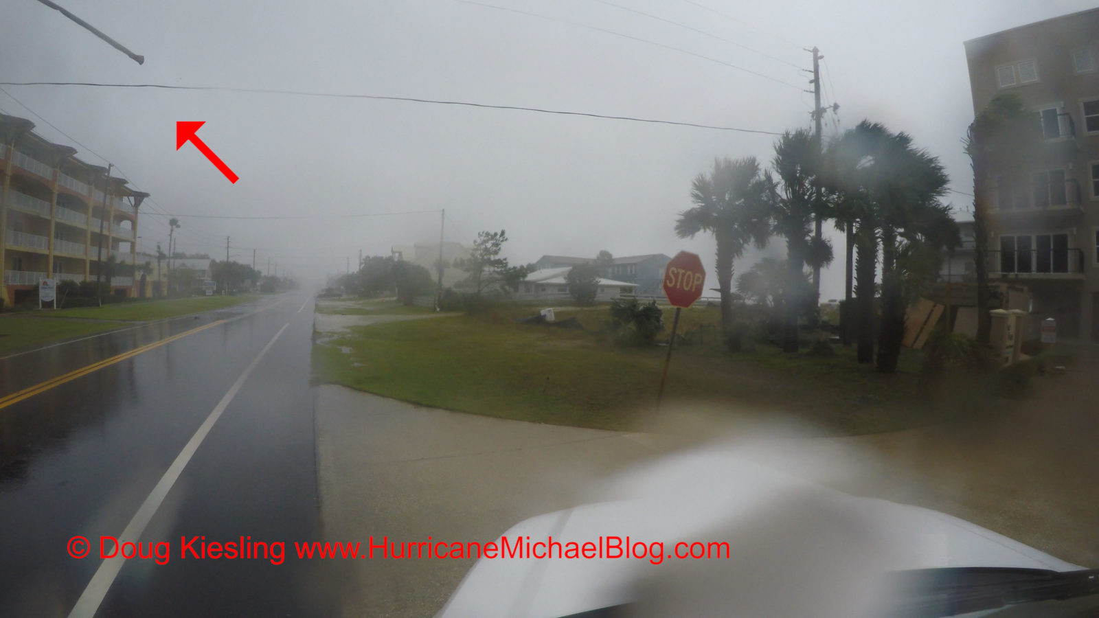
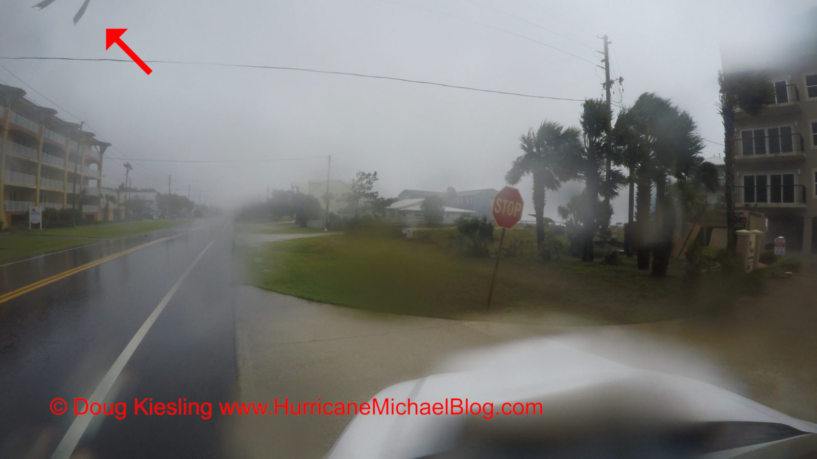
I saw a fuel station at 37th and Highway 98 that had a canopy over the fuel pumps that was starting to get ripped apart so I stopped to document it for a few minutes while knowing I needed to keep to the west side of town because the storm will go from not so fun to be out in it to completely ridiculous stupid to be out in it within only a few minutes time. Also lurking out there was the storm surge that was reported to be anywhere from 15 to 20 feet above sea level.
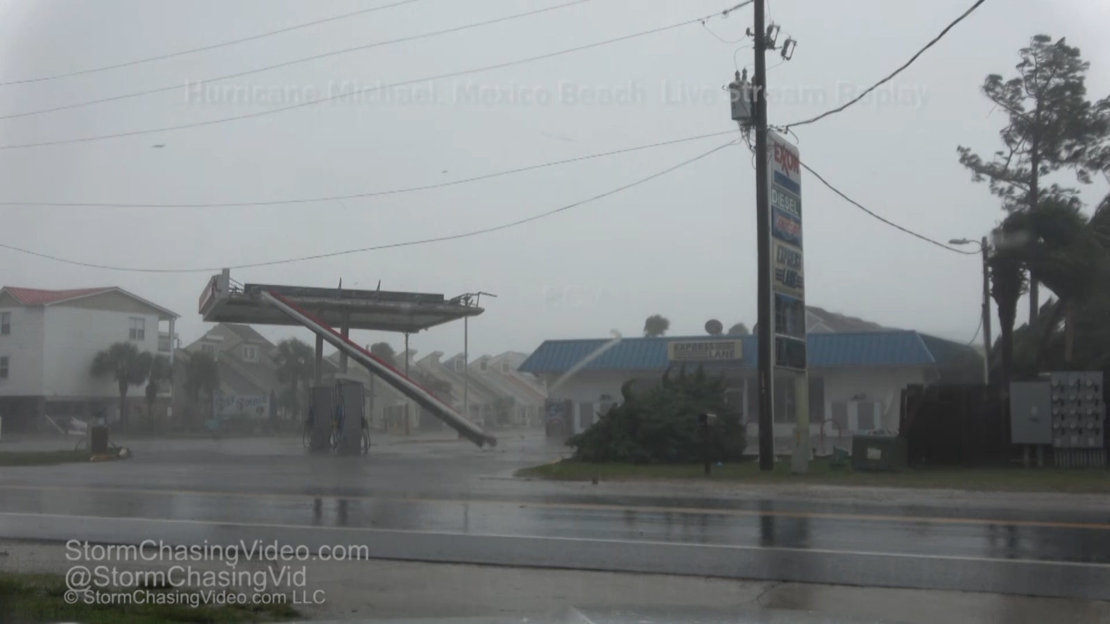
Looking back at the footage, I only spent about ten minutes documenting the fuel station canopy and the time was about just about high noon as I left this area to go and check on the storm surge situation along with the escape route to the northwest. I drove to the northwest and found that the escape route that I planned on using was perfect as the tree’s that were coming down were pretty much coming down parallel with the highway. Again, it was as if some divine intervention was watching over me.
The time now was about 12:05 PM when Lisa with Inside Edition called me and asked if I could do a Phoner or Phone Interview. Knowing that the escape route was still good, I drove back to the southeast and about a mile or so back into Mexico Beach. At 1:13:00 in the live stream replay, you see a camera fly off the top of the SUV. I did not know this at the time but the GoPro camera that I had on the roof, it blew off in the wind as I was making my way back into Mexico Beach.
Remember what I said about how the storm will go from not so fun to be out in it to completely ridiculous? The time in the live stream replay is 1:14:03 and I just as I crossed over the bridge to the canal into Mexico Beach, the weather went from not so fun, to this is pretty stupid because some larger debris is starting to fly through the air to completely ridiculous and then onto the bonus level of “You’re an idiot and going to die if you do not leave now!” All within the span of four minutes and thirty seconds, and while trying to do this Phoner for Inside Edition and ten thousand people watching the live stream waiting to see if I would die.
Remember I am driving to the southeast and straight into the heart of the right front quadrant of at the time was a Category 4 hurricane that has since been upgraded to a Category 5. So, when you stop to think about it, this is beyond “You’re an idiot and going to die if you do not leave now” to “DUDE, YOU SHOULD BE DEAD”!
You can hear in the video at 1:16:14 that I remained calm and even cracked some jokes to some other stringers watching about Forty Is Not Enough, that is about Brandon Sullivan and the El Reno, OK tornado from 5/31/2013. While driving in this blender of death and destruction of Hurricane Michael in Mexico beach, I stick my hand outside to feel if the GoPro was still attached. Sadly, it was not, and I thought I just lost it only seconds ago.
As I continued driving to the southeast, someone pointed out that they thought they saw an “Orb” fly past the car at 1:17:29. Upon looking at this further, it was kind of an orb but nothing supernatural as it was an orange construction road sign flying past me like a spinning guillotine of death. Like I said, it went to not so fun to I should be dead within five minutes.
In the video, you can see where at about 1:18:25 in the video, I turn around and head back to the northwest on Highway 98 while trying to do this interview. Yes, the debris was insane, but I also saw something out of the corner of my eye that did not look right and that was the signs of storm surge coming in.
Oh, about the interview, you can hear in the video, they wanted me to face time on a apple but I was on an Android phone… Back to the story, I was driving northwest again and doing about 30-40 miles per hour with flying debris flying past the vehicle and heading straight.
The point where I turned around was at 21st Street. I found out a week after the storm that Ginger Zee from ABC News was in a concrete bunker of a building on 22nd Street. She saw me driving past the building in the eye wall going into the wind with the debris flying all around me and wondered what and who that was.
This was the point in the eye wall that the storm surge was coming on shore. At 1:19:18 in the video, you see the first major sign of the storm surge and I was by 25th Street and Highway 98 which was only about three hundred feet from the coast. When you look at a map of Mexico Beach, you can see where I turned around at 21st Street, I was only about 200 feet from where the ocean was supposed to be. Had I gone any further to the southeast and not turned around when I did, I probably would be dead.
As the storm surge was starting to come in with forecasts of it to be as high as 20 feet, I was less then ten feet above sea level. I needed to put as much distance between me and the coast as fast as possible as the eye was now just starting to come on shore a few miles to my northwest.
For the next forty-five seconds I was able to make it down to about 34th Street before encountering storm surge yet again 6:15 in the video. I should be about six hundred feet from the coast at this point and in the video, you can see I able to keep the SUV on the road and surf the surge for the next forty five seconds until I got to about 39th Street.
After the storm is when I found out another chaser, Tony, was in the condos at located at 41st street and actually got footage of me driving in and driving out of Mexico Beach as the surge was coming in. He also got footage of the surge and when I say he got footage of the surge, he has footage of cars, boats, and even a house floating past the camera.
The time in the live stream replay is 1:22:00 and I’m at the bridge that goes over the canal on the west side of Mexico Beach, I stopped to take one last look before driving into the eye. The SUV Tire Pressure Sensors or TPS were saying that I was losing air in one or more tires and that I drove over something that punctured a tire. The tire was not flat, just a slow leak and considering at what was flying past me at all this time, having a slow leak in a tire or two was nothing compared to what should have happened to me as large debris is just flying past me but not doing anything to the SUV. So after loitering on the bridge for a minute taking one last look to the southeast, I turned around the SUV and headed northwest and into the calm of the eye.
After leaving the west side of Mexico Beach and getting past the man made structures, the tree’s acted as a wind break, In the live stream replay video from 1:22:45 you can watch as I leave the bridge over the canal and drive northwest into the eye where there are no tree’s down over Highway 98, the wind is actually pushing me and for several miles the tree’s that are down were knocked down parallel with the road, just as I had thought they would do.
For about two and a half miles, in the right front quadrant of an eye wall of a Category Five Hurricane, not one tree was down over Highway 98 until I got to Research Road on the east side of Tyndall Airforce Base.
The distance from the shore on the other side of Saint Andrews Point was 1.31 miles or 2.10km from me. I had successfully put over a mile of distance from me to the shore, and several miles away from Mexico Beach where the massive storm surge and violent winds was destroying the town. The winds around me were letting up as I was just driving further and further northwest until I could get to the center of the eye. I was not out of the woods yet, literally and figuratively speaking as I was just on the inside of the eye wall. The time in the video was 1:30:00 when I came to a point in the road where there were just too many trees down to try and go any further. According to the radar and GPS I was just inside the right front quadrant with winds blowing about ten miles per hour.
I was able to do the impossible, the unthinkable and months later, the oh my god, you got to be kidding me unthinkable, I just surfed the storm surge of Category Five Hurricane with an SUV and drove into the High Noon clear blue-sky eye. Looking back after the storm I thought to myself that more men walked on the surface of the moon then drove through the eye wall and into the eye of a category five. Now what is the next goal?
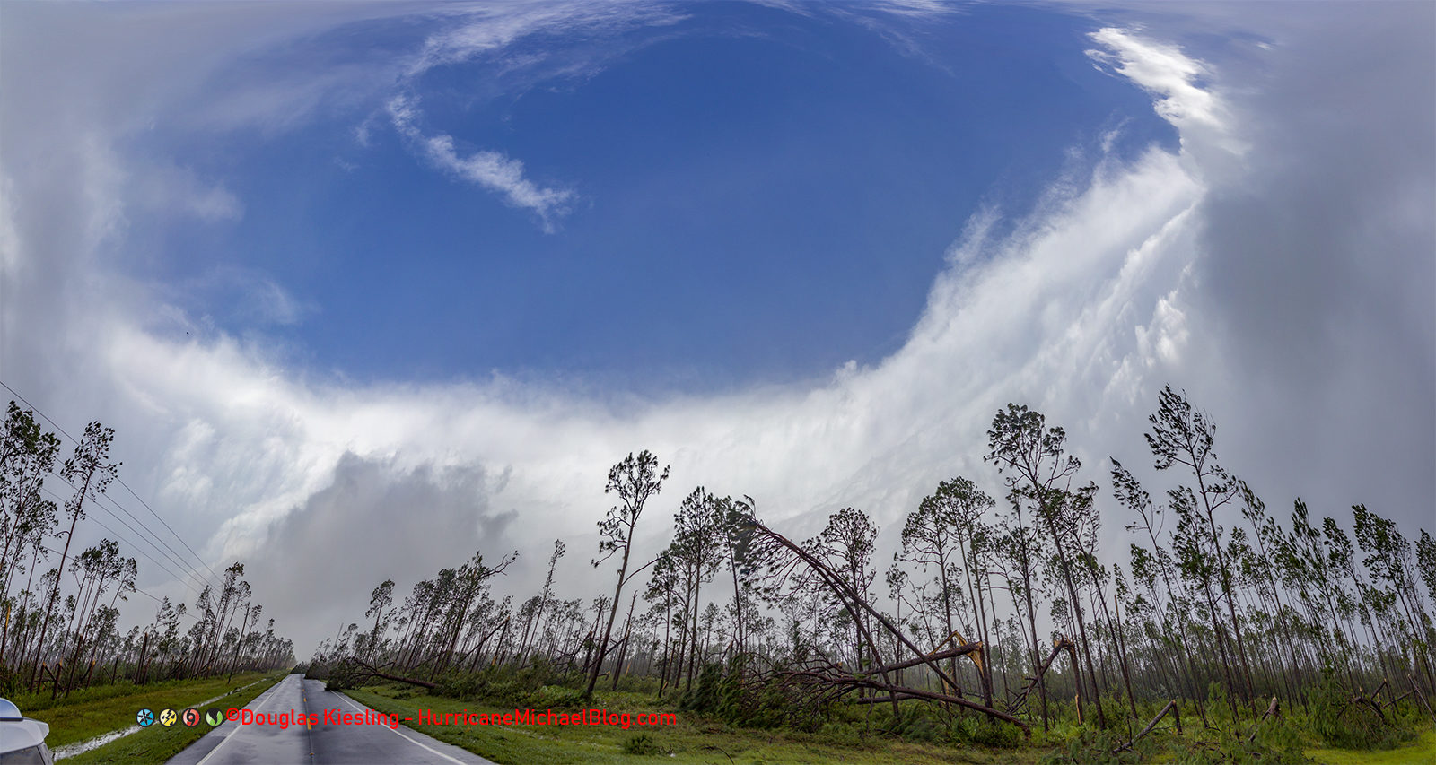
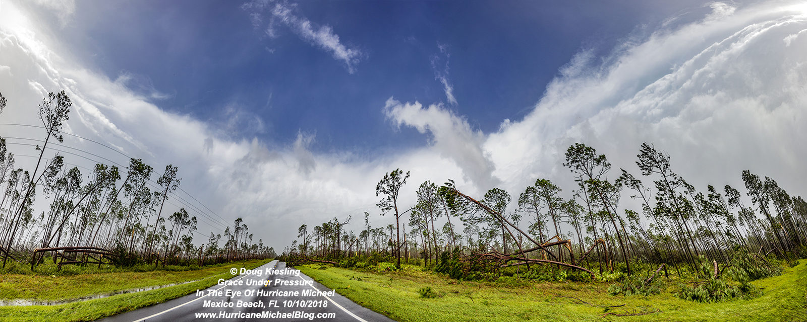
In the eye, I was able to capture several images that I have been trying all my life to get. The Clear Blue Sky of the eye of a hurricane. Never in my wildest dreams would I think I would do this in a Cat 5 Hurricane.
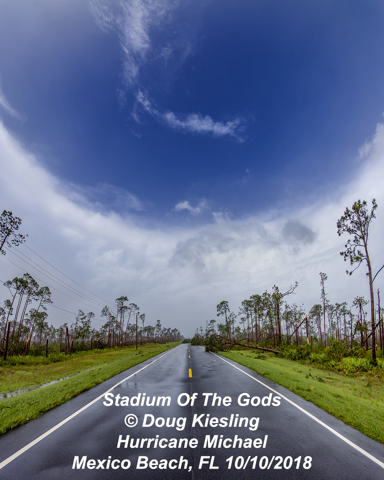
Here are three of the limited edition Fine Art prints that I have for sale on this website. Obviously the don’t include the obnoxious water mark to prevent image theft.
The First Image above is called Stadium Of The Gods.
The Second Image Is Called Look In To the Eye Of The Storm
The third limited edition print is called Grace Under Pressure, in the Blue Sky High Noon Sun at my back eye of the hurricane.
Looking over the raw footage, I was in the calm of the eye for about twenty minutes.
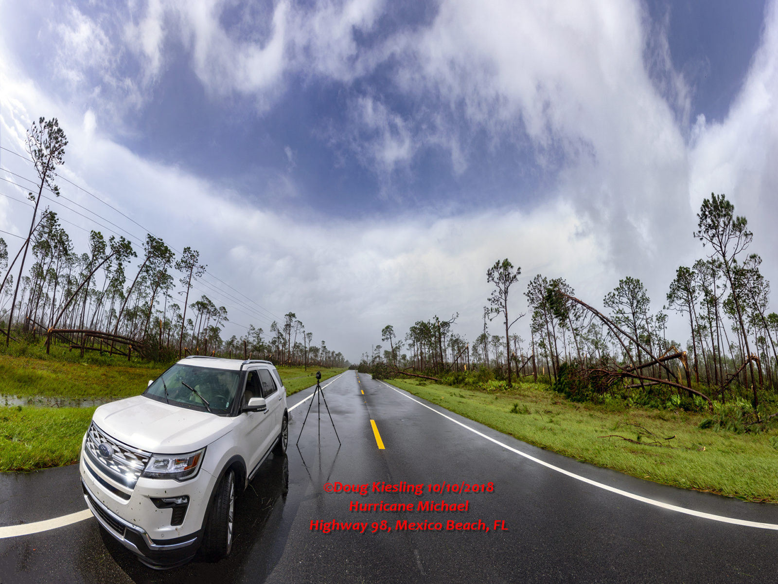
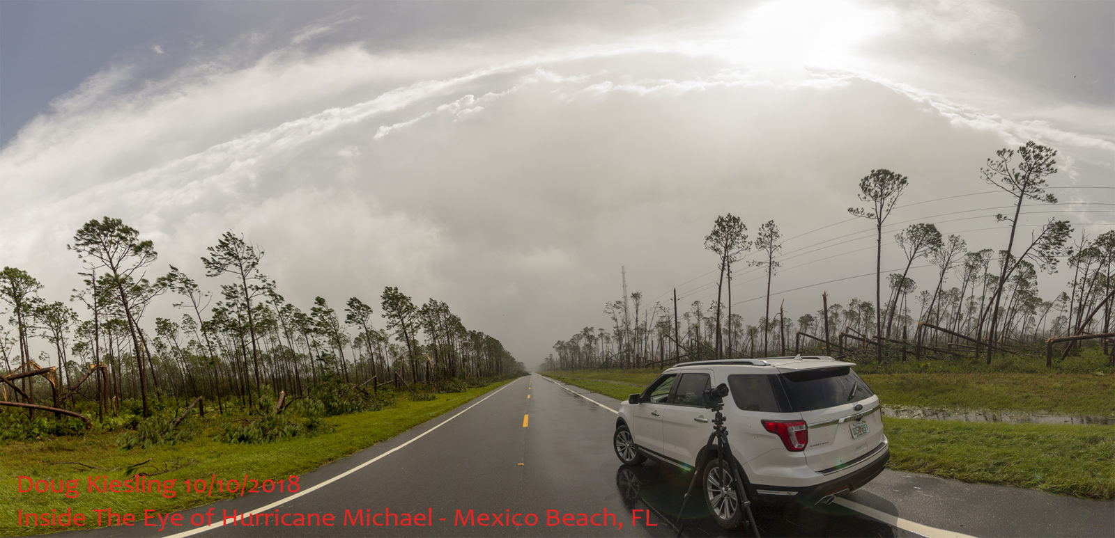
In that twenty minutes, less then ten minutes was in the clear blue sky of the High Noon Cat 5 Eye. I entered the calmer winds of the eye and inner eye wall at about 12:10 PM and the clear sky came out about 12:20 PM where the clouds were starting to break up and see the blue-sky peak through.
One of the stranger thing’s that I saw, felt heard while in the eye as hearing the roar of the winds mixed with thunder. The temperature also rapidly increased in the eye to over 90°F per the temp display on the SUV. And finally, all the birds flying around in the storm. There were so many birds flying all around up high and close to the surface that I did wonder if some of them rode up with the storm from off the coast of central America.
Remember, I was just inside the eastern eye wall of Hurricane Michael. Just behind me about a mile away was the totally violence that Simon Brewer and Juston Drake were seeing a half mile inland off 15th Street as well as the insane surge Tony was seeing at 41st Street in Mexico Beach. We were just a few miles away from each other and while I was getting a sunburn and watching birds fly around in the eye, they were hanging on for their lives.
Now you might be wondering, how did I know to do this? Drive into the eye and get inland and avoid the storm surge? It was back in 2002, I was talking with the late Jim Leonard about hurricane chasing. He told me that if I was ever in that situation, drive into the eye of the storm further inland and wait out the surge until the storm moves inland and the surge recedes.
The time now is about 12:45 and the clouds are starting to move back over me and the right rear quadrant of the storm which is pretty much just as powerful as the right front quadrant was coming up fast upon me. I packed up the cameras and got back in the SUV with about a minute to spare before the rain started back up. The time in the live stream replay is 1:53:00 when I get back in the SUV and the rain starts back up.
After the rain started back up, I drove back to the southeast on highway 98. It did not take long for me to go from hey we could have a picnic in the eye of the storm at 1:48:30 in the live replay to 1:53.48 where trees are being snapped off and thrown across the road in my path and I was entering back into to the status of it was completely ridiculous for being here.
As I was driving the few miles back to the east, a few minutes after I was in the clear blue sky of the eye, I passed Research Road again and the winds were blowing from right to left or pretty much on shore. There were no tree’s down blocking Highway 98 for several miles as they were knocked over during the right front quadrant and laid down almost parallel with the road. Granted I was in driving and crawling along in white out conditions expecting to stop at any time if a tree was blocking the road or storm surge.
The danger now was the tree’s that were not blown over before, are being blown towards the road. With near zero visibility, tree branches in the road and extreme winds, it was intense to say the least.
I was able to drive back down Highway 98 to within less then a mile or about 3,000 feet from the bridge that went over the canal on the west side of Mexico Beach, FL until I hit the storm surge. I run into the edge of the storm surge at 2:00:49 in the video.
For the next twenty minutes I’m pinned down in the eastern eye wall of a Cat 5 out in the open in a SUV and waiting out the storm surge. I do make a joke at 2:19:10 about the wife was going to be so pissed off at me for doing this when she see’s the video. Got to remain calm!!! After about twenty minutes of waiting, the storm surge has begun to recede, and I was able to move about 100 feet forward until I was once again on the edge of the storm surge. The time is 2:21:51 in the live stream replay and you can see some waves in the surge as I back up to give myself a little distance between the edge of the surge and the SUV. I’m again pinned down and just forced to wait out the storm. I do slowly creep backwards with the SUV to get back to where I was riding out the storm with the small tree’s blocking the wind for me, the time of the live stream is 2:24:30.
While just sitting around and waiting for the next twelve minutes, I was talking to those who I thought were watching the live stream and answering some text messages. So, if you hear me talking to myself, that was why I was talking to myself or just using voice to text. I later found out I was able to get messages out to people, but those who I thought I was talking to on the live stream, I was not talking to anyone anymore due to the towers being damaged and the 4G network being down.
After sitting around and waiting for the surge and wind recede some more, at 2:37:00 in the live stream replay, I attempt to try and move forward only to see that a large tree was now blocking my path at about the location where I ran into the edge of the surge fifteen minutes prior. Had I tried to drive through the surge, I might have drove into that tree or had it land on me. The time in the live stream replay is 2:38:00 and had to swap cards in the camera as they were filling up. For the next 15 minutes, I am again pinned down in this area waiting for the wind to die down a little before attempting to go any further.
At 2:56:18 in the live stream replay the winds were finally calm enough for me to get out and check for damage and attempt to put air in the tires that were now about half full. By 3:15:00 in the video the winds have really started to calm down compared to what they were just an hour ago where it was catastrophic Cat 4/Cat5 winds. This was when I was able to get out and walk around while I pumped up the tires and wait out the storm surge for the next fifteen minutes.
Now do you remember when I said my camera flew off the roof of the SUV and I lost the GoPro? You might have been wondering, if I lost the GoPro, how did I have the footage of it blowing off the top of the SUV?
You can hear my excitement at 3:32:29 where I say you will never believe what I was able to find on the side of the fricken road… Even I was shocked to find my GoPro laying on the side of the road. The case was broken, and the camera was dead from saltwater, but I was able to recover the footage off the memory card. I remember saying to myself, lord it would make one awesome story if I was able to find the camera after the storm.
I was thinking it was in Mexico Beach in a debris pile but no, it was on the side of the road right there where I was filling up the air in my tires. I was able to spot it due to the orange float I had attached to the back of it for when I used it with Laura during her swimming lessons the year before. How incredibly insane are the possibilities that I lost the camera when the wind blew it off the roof of the vehicle in some random location, even in an area that I thought it was not going to be found, then while waiting for the tires to get refilled with air, I find it while saying lord, how awesome would that story be that I found the camera after asking for help finding it. Like I have already said, I should be dead from the debris in the eye wall, I almost did not even make this trip until for some reason, everything lined up perfectly for me to make this chase. I’m chasing solo in a Cat 5 and the only damage to the SUV is some slow leaking tires?
Now this will really make you stop and think, if I did not have to stop and fill up the tires, would I have found the GoPro? Divine Intervention? Not saying but I’m just saying…
The time in the video replay is now 3:33:30, I’m finally driving back into Mexico Beach. I found parts of the road where the asphalt was ripped up from the power of the storm surge at the bridge that went over Salt Creek. One of my biggest fears is driving over a road that is washed out from underneath.
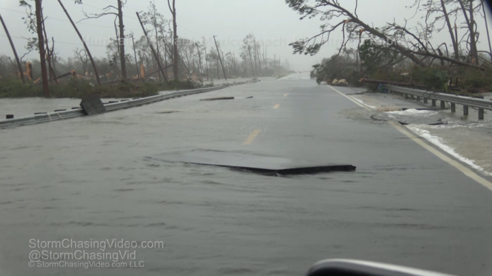
I waited here for another 10 minutes and got out of the SUV to walk the road in the Tropical Storm force winds and check out the road to make sure it was still there and solid enough for traffic to drive over it.
At 3:42:00 in the live video replay I begin to drive back into Mexico Beach to the bridge over the Canal from Salt Creek and the devastation was just mind blowing to see. You must remember; this is not the next day when 99.9% of the rest of the media finally got into Mexico Beach to see what happened and the total devastation. The time was about 2:25 PM in the afternoon, the winds were still screaming at Tropical Storm Force and the Storm Surge is still receding form the area and is only just below the road elevation now on the far west end of town. This was still an active storm and debris was still being blown around.
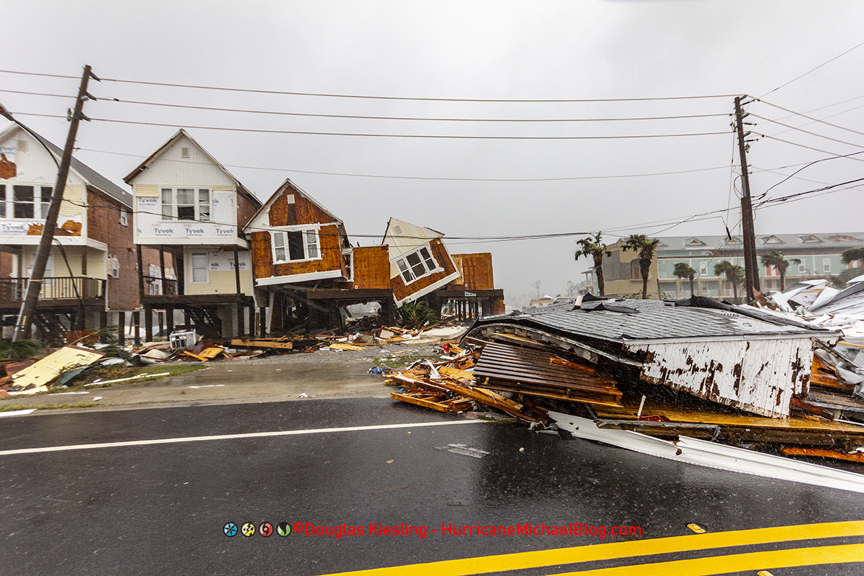
The brutal force of the Cat 5 winds from Hurricane Michael pushed over these homes in Mexico Beach.
As I crested the top of the canal bridge, I got the first full view of the debris on Highway 98. Nothing was untouched in Mexico Beach by Hurricane Michael. Everything was damaged or destroyed. Debris was everywhere and several houses that took the full broadside force of the Category Five winds and where knocked over.
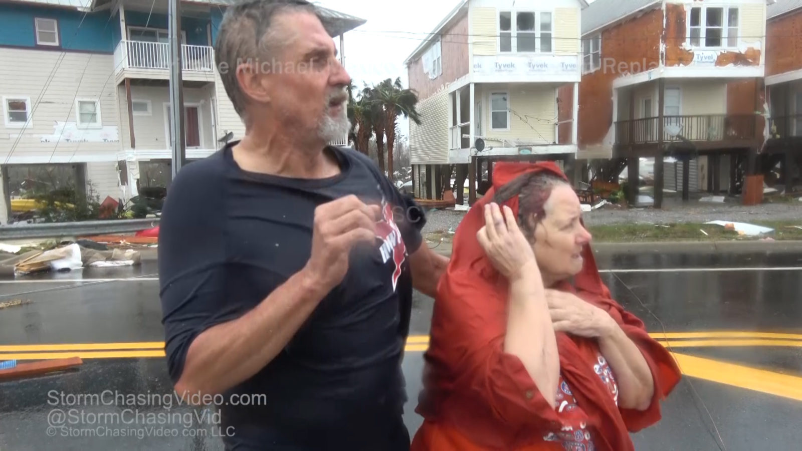 From this point all I was focused on was documenting the aftermath as the storm surge was draining back out to the Gulf Of Mexico. I got a great example of this with debris of a home floating out to sea at 3:50:00 in the live feed replay. I thought I was totally alone at this point until a man and woman flagged me down that is at 3:52:15 in the replay. It was Carolyn Metcalf and her son Scott Cawthron. They were in very rough shape to put it mildly.
I am not a EMT and nor do I have any training or even medical supplies to help or bandage up anyone or myself. I went back to the SUV and tried to make some calls, but all the service was out except for text messages. I was able to get a message out to a couple of friends via text message. One was to a friend at ABC News who told me Ginger was also there and they were trying to get the word out. I also got word out to a couple of friends to call The Weather Channel and let them know that there are injured people here. Calling and Texting 911 was not even an option at this point since all emergency services were evacuated out of the area prior to the storm.
After trying to get the message out to get someone to get some type of help into the area, I saw that Scott and his mom were standing out under one of the yellow houses on stilts that had two of the homes blown over from the wind. I walked over to a house that was next to the yellow houses and was prepared to kick in the door or pry it open in order to get Scott and his mom into someplace safe and out of the elements until help could reach them. I figured this place would be locked up tight to prevent looting and it would take some time to get them out of the storm.
As I walked up to the door of this home, I said another small prayer asking for help saying lord please let this door be open even though I was ready to kick it in, I tried to turn the doorknob… it was open.
Don’t ask me how it was unlocked but it was and the mission now was not to get video but to clear a path in the debris that was full of boards with nails, sharp objects and pretty much stuff that was left after the surge that would hurt you if you stepped on it with bare feet. I cleared a walking path to them and got them to the door so they could go upstairs and take shelter until help arrived. I knew that in survival mode, this was not breaking and entering but taking shelter of last resort until help arrived. Plus, if you would have seen her the injury to her foot, yeah it was not pretty. I did receive a call about a month later from the owner of the home thanking me for helping them out and he was okay with them taking shelter until help arrived. It turns out Scott and his mom wrote the owner of the home a note telling them what happened and why they were there.
Now that Scott and him mom were out of the rain and in a safe place until help arrived, I went back to documenting what was left of the storm and what was left of Mexico Beach, Florida.
One thing that I saw a lot of was this insanely strong but thin wire all over the place that was more like trip wires since they were very hard to see and just above the ground and interwoven with the debris. Turns out that was deep sea fishing line that was all over the place from all the destroyed boats.
For the next hour, I did not see another living soul in Mexico Beach while I was documenting the aftermath on the west side of town. I found whole areas where the older homes that were not on stilts were completely washed away as if hit by an EF5 Tornado. At one point, I was standing on top of a roof that was no longer attached to any structure but allowed me to walk up on it and get a bird’s eye view of the devastation that was everywhere.
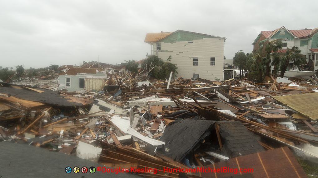
Total destruction from Hurricane Michael in Mexico Beach, FL
It was so strange, I was walking around in what could only be called a ghost town, for the next hour, I did not see another living creature, no animals, no people, just the constant sound of fire alarms screaming. Everything was destroyed. I kept thinking to myself, other then Scott and his mom, was I the only one left alive? After all of the other hurricanes that I have been in, by this time I would have started seeing other people out in the aftermath. I saw nobody and no emergency services that were trying to get back into town.
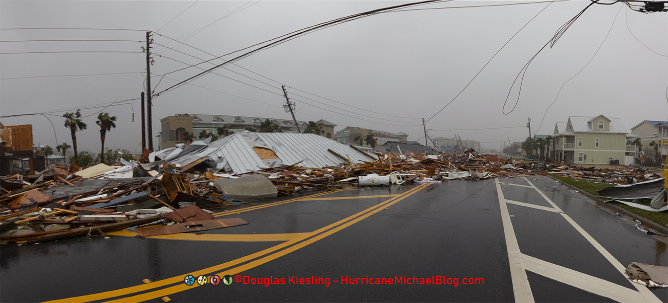
Massive amounts of Debris cover Highway 98 in Mexico Beach, FL.
After about ninety minutes had passed, the weather was calming down and I finally saw a couple of men walking towards me on Highway 98. They did not look very happy and were looking for their boat. Turns out their boat pretty much floated across town and ended up ended up in the debris by the canal bridge.
Seeing all the damage, I concluded that I was not making it out of Mexico Beach that night and I was going to have at least two flat tires come morning. I said one last little prayer saying god if your listening, I could really use a can of Fix A Flat for my tires to get out of here whenever they clear the road.
I kept on documenting the aftermath and the piles of debris and destroyed homes when I finally made it back to the area where the fuel station was that I was documenting the canopy being blown apart. The aftermath was insane. Here is a before and after look at the scene.

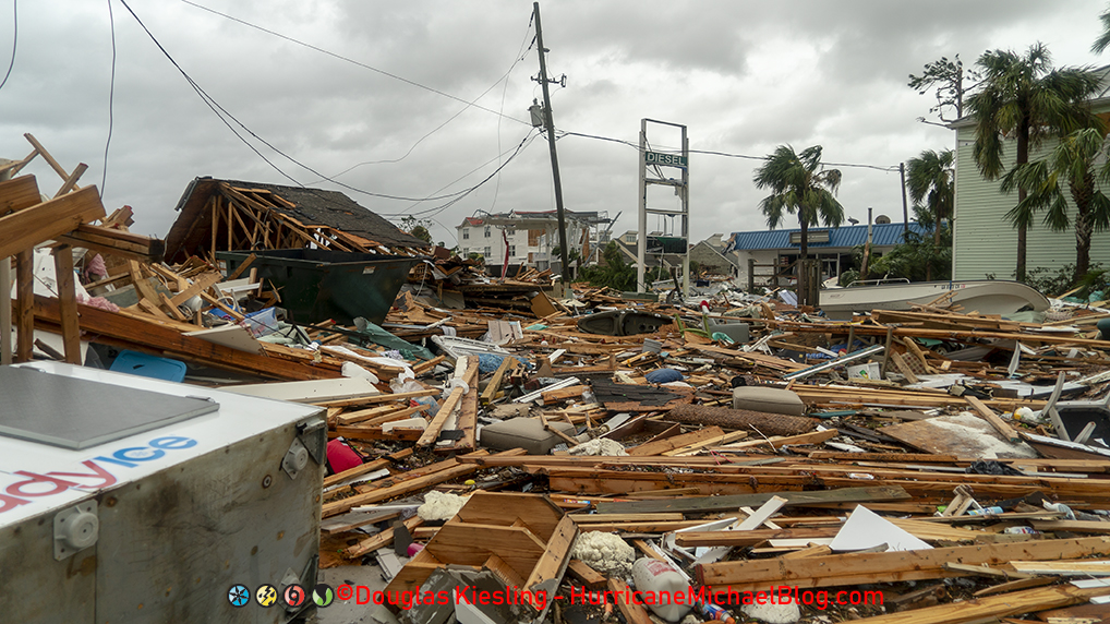
Massive amounts of debris blocking Highway 98, Mexico Beach, FL after Hurricane Michael.
I looked at where I was parked while the canopy was being blown apart, and it was a huge debris pile. If I would have stay there, I would again be dead.
The debris and the fishing line trip wire was covering the road from side to side from where I was parked to the fuel station and was almost impossible to walk past it. You had to walk over the debris and even then, I needed to use my tripod as kind of a walking stick just to get around to the other side of the debris to continue documenting the aftermath. .
Now remember I asked for help finding a can of Fix A Flat? As I was walking over the debris pile in the photo above, in the middle of the massive debris pile in the road and untouched with the cap still on it was a can of Fix A Flat for large truck tires. I had a smaller SUV so once again my prayers where answered by what can only be divine intervention or I’m just crazy lucky.
I continued to document what I could, but the sun light was starting to fade as the hour was getting late and the storm was now over for the area. I started to make my way back to my SUV when I ran into a few other men out walking around in the aftermath. One of the men was Tony who saw me driving round before the surge hit and got some insane footage. When he found out that was me driving around, even he thought I was dead. I told him about all the strange luck I was having and he got it and knew what was happening.
It was about this time that to my surprise I started to see headlights working their way towards Mexico Beach. My thoughts were back to getting help for Scott and his mother. A little while later the vehicles finally made it up to where I was parked on the bridge. It was not EMS to come to help but a couple of other chasers, Von Caster and John Humphries, that came in looking for me and a couple other chasers the nobody had heard from after their spotter network icons stopped reporting movement. They thought the chasers were dead and asked if I had seen a few other chasers and told them that outside of the two that were injured that I got into a house to wait for help, I have only see a hand full of people including them but no other chasers. John did ask if I got the eye and I said, yes, it was everything and more with the stadium effect, it was super natural. John in a jokingly way as most chaser do when they found out the missed the storm or the shot and someone else got it, said “Ugh, I hate you…” with a smile.
I asked them how they got into Mexico Beach and they said the water had drained from the side of the road and the ground was pretty much hard coral and grass so they could drive around the downed trees. They had 4×4 but my rental, that was a front wheel drive Ford Explorer so I was not going to risk trying to get injured people out when there was a great chance, I could get stuck just trying to get out of the area. I did tell them about Scott and his mom to see if maybe they could get them out but they said they were not going back to Panama City that night as the curfew was in place and it was pretty sketchy over there already.
The sun was setting fast and in the fading light, I used the can of Fix A Flat on the two tires and then preceded to use the air compressor to fill up the tires before trying to make a run for it out of Mexico Beach.
We did see a US Coast Guard plan circling the area at about 5,000 feet up at dusk and we could only assume they were doing a damage survey in infrared.
As soon as the tires were full and I got something to eat, cold ravioli, I got the truck in order to get out of the area, I said good bye to Von and John and started to make my way back to the northwest to try and get out of the impacted area and back to Destin, FL where I was hoping everything was fine and I had a Hotel and Internet service where I could edit this historic footage and photos and get the word out about the fate of Mexico Beach.
The drive out was rough and slow going as the amount of tree’s down on the west side of Tyndall Airforce Base was a lot more then on the east side as the winds on the west side of the eye where all offshore and perpendicular to the road.
On the way into Mexico Beach, I saw a weather instrumentation tower that was put placed there by Florida State University. When I was leaving the area, I saw it again but this time it was laying across the road.
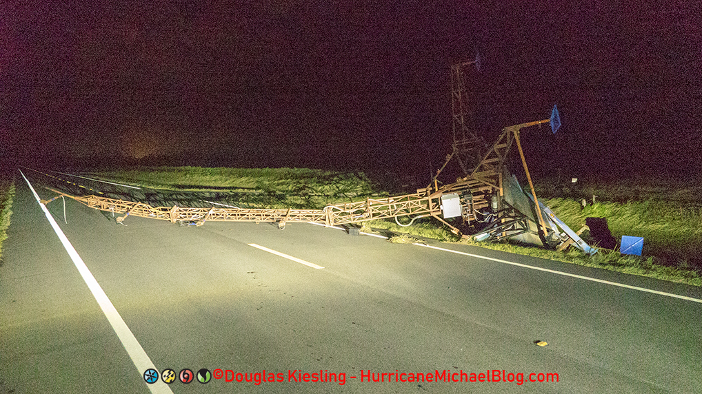
Florida State University Hurricane Probe Tower blocking Highway 98 after Hurricane Michael
Again, divine intervention or just plan lucky, as I rolled up to the tower blocking the road, two Jeeps were coming from the other direction. It was a couple of volunteers that called themselves the Flip Flop Flotilla of the Cajun Navy. They said they were going to try and get in to help and I told there where Scott and his mom were waiting for help on the west side of town in the house, I got them into. They were able to reach them and helped stabilize them and get them out of Mexico Beach in the morning to a hospital in the Panama City area.
My story does not end there. When I got to the entrance of Tyndall AFB, I saw some security detail walking around with flashlights and looking at the damage. I told the officer in charge about what happened on the other side of the base and that the fence line was gone and so was most of Mexico Beach. Asked him if they had any radio or communication with the Bay County Emergency Operation Center and they said they would try but right now they were trying to asses the base or what was left of it.
Further down the road as I got into Callaway, Florida and I saw a police car on the side of the road. I stopped to talk with the officer and told him what I just drove out of and asked if he could let EOC know the status of the road going to Mexico Beach and the status of Mexico Beach. He thanked me but warned me that on the west side of the storm, it was also bad with the number of tree’s down and roads blocked along with storm damage and all the people that did not leave, they had their hands full with everything and on top of it, looters.
As I was leaving, the area after talking to the officer to get the word out, I figured my work is done here, I got help going to Scott and his mom, told the base security and the police officer about the situation in Mexico Beach. I still had over three fourths of a tank of gas in the SUV along with all the fuel cans that were still full in the back of the SUV, I just needed to make it to Destin.
To try and make it out of the east side of Panama City, I was following a path that the police officer was making, and I drove through the roads and over medians until and we were blocked by a huge downed tree over highway 98. The officer turned off and parked, but I turned around to go back the way I came to try and find another away out. I drove up over a grass median that we just were on to try and get out and sure enough, just as I was trying to make it the last few miles out, in the middle of what I was told was a lawless looting free for all by the officer and the guys from the Cajun Navy that warned me about the looting and to just spend the night by the base security as it was not safe in Panama City, I got stuck.
Yes, stuck, not moving, no 4×4, no All Wheel Drive, stuck in a muddy rut in the median that I just drove through. On the other side of the median was a pickup truck with five men in it and when they saw I was stuck, they got out and came towards my vehicle. I was thinking to myself that no way was I going to get mugged for my camera gear after surviving that storm, no way could this be happening now. That was when I saw one of the men’s shirts that said Jesus. Without asking, they said they would help me get back on the road and all of them got behind my SUV and helped push me out of the rut in the mud and back on to the road.
They asked where I was from and where I was going. I told them about Mexico Beach and all the crazy stuff I saw and how I was trying to get back to Destin, FL to get the story out. They were shocked that I was coming from Mexico Beach and even more shocked that I was trying to get to Destin but they told me to follow them. They led me through back alleys and side roads where their were no downed tree’s or debris blocking the roadway to get back to where I could make it from Highway 98 in Panama City, over the causeway bridge and then continue out of the impacted area through Panama City Beach and to the west where it was pretty much untouched.
I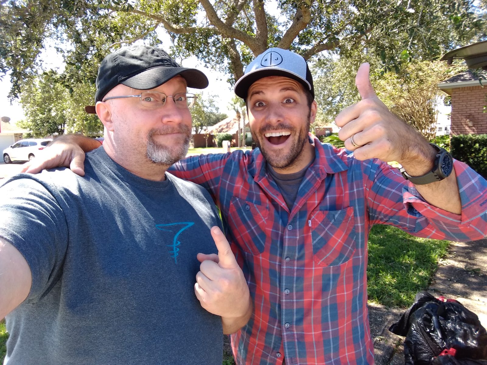 was able to make it back to the hotel before midnight and got several packages edited for the morning shows along with some phone interviews about what I saw and the video of Scott and him mom talking about surviving the storm.
The next day, I finally met up with my friend Michael and as promised I gave him the going away present of fuel cans that were full of fuel and the hurricane flags along with the bottles of water I had left over from this chase. A few days later when I was back home, I saw that he posted on Facebook that after I left, his family drove over to Panama City and the fuel I gave him and even some of the cans were handed out to people in need later that day.
Oh and wait, you are probably wondering what happened to the Rental SUV?
How bad was it damaged?
What did it really look like?
There had to be something smashed, trashed, broken, busted scratched on the thing, there is no way that just a couple of slow leaks in the tires was all the damage that occurred to the thing? Well, you be the judge, I took these photos the next day.
All that is wrong is it was dirty, some vegetation stuck in the front under the light and mud from when I got stuck in the mud. Nothing is broken, no new major scrapes or scratches that were not already there before me and remember this was a rental vehicle that had over 20,000 miles on it before I drove it through the right front quadrant of a Cat 5 and into the eye. All it needed was a good cleaning and a set of new tires since to be honest, the tires that were on there were junk to begin with before I got my hands on it.
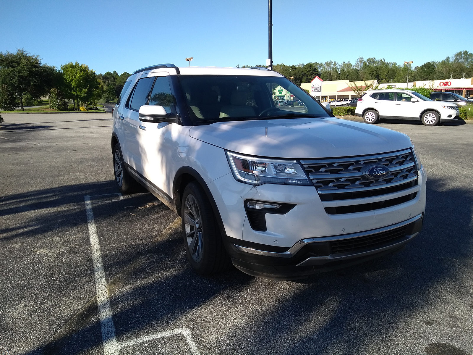
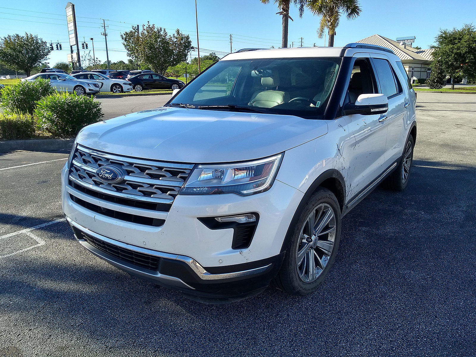
After I took those photos of the SUV, I made a few phone calls to the rental car company and asked about an extension or if I could drop it off at another location as it turned out that Interstate 10 was shut down from Destin, FL to just west of Jacksonville, FL and my hotel was in Jacksonville that night and my flight out the next day. The rental car company said, no problem, we understand there was a major storm and as long as you bring it back to any location in the next 48 hours you won’t be charged a one way fee or extra fee’s beyond the normal daily rental charges.
I checked on line and found I could fly out of New Orleans the next day. It was pretty epic driving to New Orleans, LA after Hurricane Michael since New Orleans was where I was solo for Hurricane Katrina. I did go into downtown and drove Canal Street before going to my hotel that night.
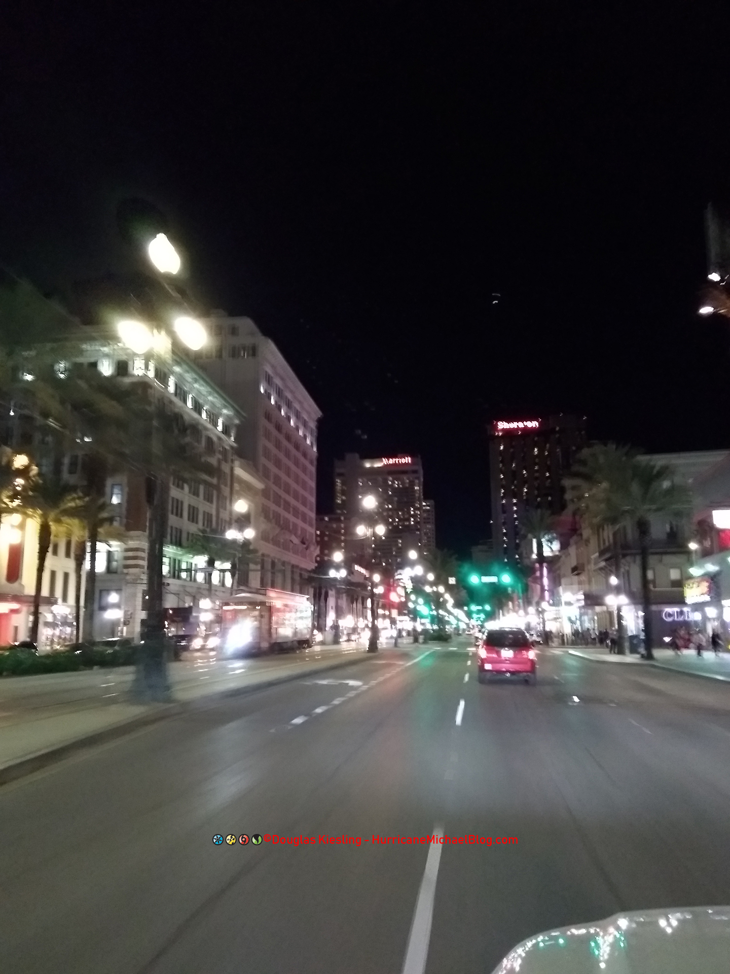
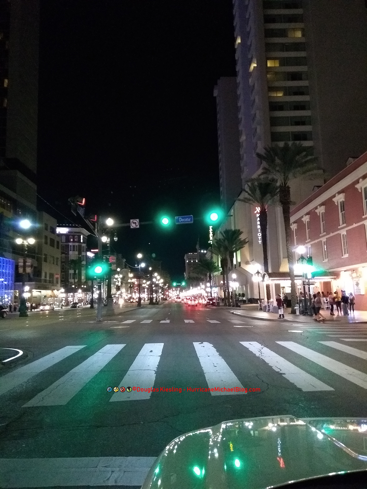
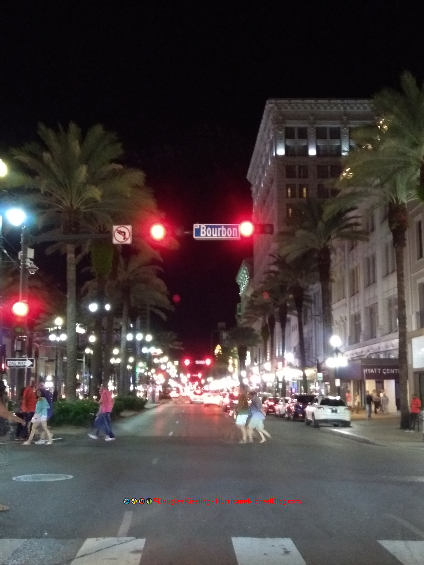 It was cool seeing New Orleans, LA 13 years after Katrina right after I survived a Cat 5 in Mexico Beach. It was like something was telling me that even though everything seemed so bad for everyone impacted by Michael, in time, the area will recover and be better then ever.
Widescreen WordPress Theme by Graph Paper Press All content © 2025 by Hurricane Michael Blog